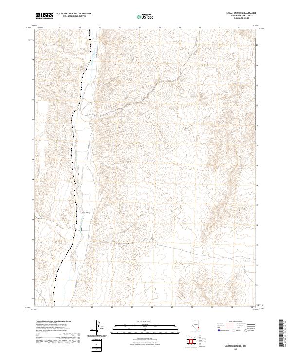
2021 Map of Lyman Crossing
USGS Topo · Published 2021About this map
Meadow Valley Wash winds through a landscape defined by the drainage patterns of southeastern Lincoln County. This 2021 study of the Lyman Crossing quadrangle details a high-desert environment where water and transport routes are the primary markers of human presence. The north-south corridor of Co Rte 4230 serves as the main artery for the area, closely following the terrain near Long Valley. The map highlights the vast network of townships and ranges, including t8s r67e and t9s r68e, which structure this segment of the Great Basin. By documenting the current hydrology and road systems, this USGS map illustrates the persistent importance of natural watercourses like the Meadow Valley Wash in guiding the limited infrastructure of this remote Nevada region.
Find a feature on this map
8 named features on this map. Tap any name to fly to it.
Don’t see what you’re looking for? This feature index may not catch every label — zoom into the map to look around manually.
Map Details
Editions of this 2021 Lyman Crossing Map
This is the sole edition of this map. No revisions or reprints were ever made.
Other maps of this area

1885 · Pioche
USGS Topo · 1:250,000

1886 · Pioche
USGS Topo · 1:250,000

1954 · Caliente
USGS Topo · 1:250,000

1959 · Caliente
USGS Topo · 1:250,000

1969 · Elgin
USGS Topo · 1:24,000
1969 · Vigo
USGS Topo · 1:24,000
1969 · Vigo NE
USGS Topo · 1:24,000
1973 · Leith
USGS Topo · 1:24,000
1973 · Toquop Gap
USGS Topo · 1:24,000
1973 · Blue Nose Peak
USGS Topo · 1:24,000