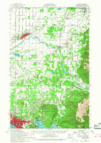
1954 Map of Lynden
USGS Topo · Published 1968About this map
The British Columbia Washington border defines the northern edge of this Whatcom County landscape, where the Sumas River and Nooksack River carve through fertile lowlands and timbered slopes. In the mid-1950s, the region was a network of rail-supported agriculture and rural community hubs. The Chicago Milwaukee ST Paul And Pacific and Northern Pacific railroads intersect at the bustling town of Sumas, while Lynden serves as a primary settlement west of the river. Small communal gathering places like Tenmile Grange and the Grange Hall near Goshen highlight the era's social fabric. Industrial activity is visible at the Larson Mill on Lake Whatcom and scattered Gravel Pit locations. To the south, the northern reaches of Bellingham begin to expand near Squalicum Mountain, showing the city's growth toward Bloedel-Donovan Park and the waterfront at Bellingham Bay.
Find a feature on this map
82 named features on this map. Tap any name to fly to it.
Don’t see what you’re looking for? This feature index may not catch every label — zoom into the map to look around manually.
Map Details
Editions of this 1954 Lynden Map
3 editions found

Other maps of this area

1906 · Sumas
USGS Topo · 1:62,500

1907 · Blaine
USGS Topo · 1:62,500

1908 · Sumas
USGS Topo · 1:62,500

1918 · Samish Lake
USGS Topo · 1:62,500

1919 · Van Zandt
USGS Topo · 1:62,500

1921 · Wickersham
USGS Topo · 1:62,500

1943 · Anacortes
USGS Topo · 1:62,500

1951 · Wickersham
USGS Topo · 1:62,500

1951 · Anacortes
USGS Topo · 1:62,500

1951 · Van Zandt
USGS Topo · 1:62,500