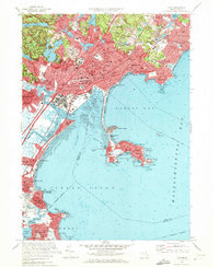
1970 Map of Lynn
USGS Topo · Published 1972About this map
Lynn dominates this coastal landscape, showing a dense mid-century urban fabric defined by a network of public schools, neighborhood churches like St Marys Ch, and expansive burial grounds including Pine Grove Cemetery. The relationship between the city and its water dominates the geography, with the industrial Saugus River corridor and Lynn Harbor contrasting with the more recreational shoreline of Swampscott and the thin land bridge leading to Nahant.
Find a feature on this map
152 named features on this map. Tap any name to fly to it.
Don’t see what you’re looking for? This feature index may not catch every label — zoom into the map to look around manually.
Map Details
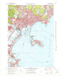
Editions of this 1970 Lynn Map
2 editions found
Other maps of this area

1886 · Lawrence
USGS Topo · 1:62,500

1888 · Lawrence
USGS Topo · 1:62,500

1888 · Salem
USGS Topo · 1:62,500

1892 · Boston Bay
USGS Topo · 1:62,500

1893 · Salem
USGS Topo · 1:62,500

1893 · Boston
USGS Topo · 1:62,500

1893 · Lawrence
USGS Topo · 1:62,500

1903 · Boston
USGS Topo · 1:62,500

1903 · Boston Bay
USGS Topo · 1:62,500

1917 · Salem
USGS Topo · 1:62,500