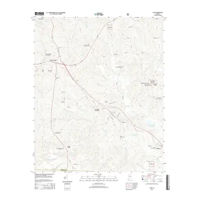
2014 Map of Lynn
USGS Topo · Published 2014About this map
The town of Lynn serves as the central hub of this northern Alabama landscape, situated near the headwaters of several key waterways including Blackwater Cr and Splunge Cr. The geography is defined by a high concentration of Baptist churches and family cemeteries, suggesting a deeply rooted rural community structure. To the northwest, the unique geological formation Natural Bridge of Alabama stands near the settlement of Natural Bridge, while the southeastern corner is punctuated by the community of Ashbank and the heights of Millstone Mtn. Large portions of the eastern terrain are managed as part of the William B. Bankhead National Forest. This mapping reveals a sophisticated network of county roads, such as CR-356 and CR-49, that connect smaller localities like German Crossing and High Point to the regional arteries of Us-278 and Al-5.
Find a feature on this map
99 named features on this map. Tap any name to fly to it.
Don’t see what you’re looking for? This feature index may not catch every label — zoom into the map to look around manually.
Map Details
Editions of this 2014 Lynn Map
This is the sole edition of this map. No revisions or reprints were ever made.
Other maps of this area

1893 · Jasper
USGS Topo · 1:125,000

1936 · Delmar
USGS Topo · 1:24,000

1936 · Goddard
USGS Topo · 1:24,000

1949 · Nauvoo
USGS Topo · 1:24,000

1950 · Nauvoo
USGS Topo · 1:24,000

1953 · Birmingham
USGS Topo · 1:250,000

1956 · Birmingham
USGS Topo · 1:250,000

1956 · Gadsden
USGS Topo · 1:250,000

1957 · Birmingham
USGS Topo · 1:250,000

1958 · Gadsden
USGS Topo · 1:250,000