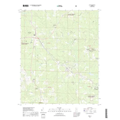
2018 Map of Lynn
USGS Topo · Published 2018About this map
Natural Bridge of Alabama stands as a primary landmark in this section of the Cumberland Plateau, where the town of Natural Bridge and the nearby village of Lynn anchor a landscape defined by deeply incised creek valleys. The terrain is marked by numerous family and community burial grounds, reflecting the deep-rooted settlement history of the region. Notable sites include Mount Vernon Missionary Baptist Church Cem, Sardis Number 1 Baptist Church Cem, and the Ingle & Wakefield Cem.
Find a feature on this map
94 named features on this map. Tap any name to fly to it.
Don’t see what you’re looking for? This feature index may not catch every label — zoom into the map to look around manually.
Map Details
Editions of this 2018 Lynn Map
This is the sole edition of this map. No revisions or reprints were ever made.
Other maps of this area

1893 · Jasper
USGS Topo · 1:125,000

1936 · Delmar
USGS Topo · 1:24,000

1936 · Goddard
USGS Topo · 1:24,000

1949 · Nauvoo
USGS Topo · 1:24,000

1950 · Nauvoo
USGS Topo · 1:24,000

1953 · Birmingham
USGS Topo · 1:250,000

1956 · Birmingham
USGS Topo · 1:250,000

1956 · Gadsden
USGS Topo · 1:250,000

1957 · Birmingham
USGS Topo · 1:250,000

1958 · Gadsden
USGS Topo · 1:250,000