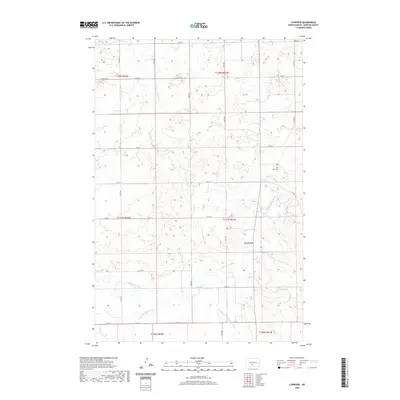
2020 Map of Lynwood
USGS Topo · Published 2020About this map
Lynwood serves as the central focal point of this Morton County landscape, situated near the confluence of several local waterways. The terrain is deeply defined by the branching network of the Little Heart River, including the N Br Little Heart River and the Southeast Br Little Heart River. These drainage patterns illustrate a complex prairie topography where water flow has carved distinct paths through the plains. To the northeast, the Saint Johns Cem provides a specific point of interest for genealogists tracing family roots in this rural township structure. The map detail reflects the modern grid of county roads, such as Co Hwy 81 and Co Rd 137, which overlay the traditional section lines of the Public Land Survey System.
Find a feature on this map
28 named features on this map. Tap any name to fly to it.
Don’t see what you’re looking for? This feature index may not catch every label — zoom into the map to look around manually.
Map Details
Editions of this 2020 Lynwood Map
This is the sole edition of this map. No revisions or reprints were ever made.
Other maps of this area

1907 · Bismarck
USGS Topo · 1:125,000

1950 · Bismarck
USGS Topo · 1:24,000

1951 · Bismarck
USGS Topo · 1:62,500

1951 · Mandan
USGS Topo · 1:24,000

1954 · Bismarck
USGS Topo · 1:250,000

1958 · Bismarck
USGS Topo · 1:250,000

1962 · Schmidt
USGS Topo · 1:24,000

1962 · Bismarck
USGS Topo · 1:24,000

1962 · Mandan
USGS Topo · 1:24,000

1972 · Crown Butte Lake
USGS Topo · 1:24,000