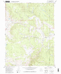
1980 Map of Lynx Pass
USGS Topo · Published 1986About this map
Routt National Forest dominates this mountain landscape, which is marked by high-altitude water management and specialized surveying. The terrain is characterized by geological features like the Muddy Slide and Deadman Park, reflecting the naming conventions of early settlers and foresters. Water resources are central to the area's development, evidenced by the Hadley Reservoir and Bulkley Reservoir, which suggest intentional landscape modification for ranching or forest management.
Find a feature on this map
34 named features on this map. Tap any name to fly to it.
Don’t see what you’re looking for? This feature index may not catch every label — zoom into the map to look around manually.
Map Details
Editions of this 1980 Lynx Pass Map
4 editions found
Other maps of this area

1954 · Craig
USGS Topo · 1:250,000

1956 · Gore Pass
USGS Topo · 1:62,500

1957 · Craig
USGS Topo · 1:250,000

1957 · Leadville
USGS Topo · 1:250,000

1958 · Craig
USGS Topo · 1:250,000

1959 · Leadville
USGS Topo · 1:250,000

1960 · Leadville
USGS Topo · 1:250,000

1960 · Craig
USGS Topo · 1:250,000

1962 · Leadville
USGS Topo · 1:250,000

1962 · Craig
USGS Topo · 1:250,000