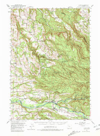
1951 Map of Lyons
USGS Topo · Published 1981About this map
Silver Creek Falls State Park and the surrounding timberlands of the Willamette Hills define this mid-century survey of the Cascade foothills. The map documents an intricate network of waterfalls, including South Falls, Lower South Falls, and Winter Falls, preserved within the recreational area while industrial activity continues nearby. The southern portion of the sheet follows the corridor of the North Fork Santiam River, where the Southern Pacific railroad serves the valley communities of Lyons and Mehama.
Find a feature on this map
63 named features on this map. Tap any name to fly to it.
Don’t see what you’re looking for? This feature index may not catch every label — zoom into the map to look around manually.
Map Details
Editions of this 1951 Lyons Map
4 editions found

Other maps of this area

1916 · Estacada
USGS Topo · 1:125,000

1921 · Lebanon
USGS Topo · 1:62,500

1922 · Lebanon
USGS Topo · 1:48,000

1923 · Mount Angel
USGS Topo · 1:62,500

1924 · Lebanon
USGS Topo · 1:62,500

1925 · Stayton
USGS Topo · 1:62,500

1929 · Mill City
USGS Topo · 1:125,000

1939 · Molalla
USGS Topo · 1:62,500

1940 · Molalla
USGS Topo · 1:62,500

1940 · Lebanon
USGS Topo · 1:62,500