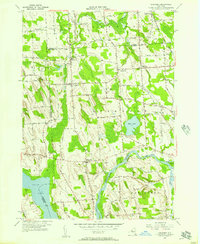
1955 Map of Lysander
USGS Topo · Published 1957About this map
The Seneca River and the adjacent Erie Canal define the southern landscape of this central New York region, where the town boundaries of Granby, Lysander, and Van Buren converge. In the mid-1950s, the area remained largely agricultural, anchored by small rural crossroads such as Plainville, Little Utica, and Jacksonville. The map captures a detailed network of named farm-to-market roads and local landmarks, including the distinctive Pinnacle Hill and the waters of Mud Lake. Of particular interest to genealogists are the rural burial sites and places of worship, such as Merritt Cem, Merritt Ch, and the Kingdom Cem located near the settlement of The Kingdom. The Delaware Lackawanna and Western railroad skirts the eastern edge, while the broad expanse of Cross Lake marks the southwestern corner, illustrating the complex relationship between the region's glacial topography and its historic transportation corridors.
Find a feature on this map
70 named features on this map. Tap any name to fly to it.
Don’t see what you’re looking for? This feature index may not catch every label — zoom into the map to look around manually.
Map Details
Editions of this 1955 Lysander Map
3 editions found
Other maps of this area

1900 · Baldwinsville
USGS Topo · 1:62,500

1900 · Oswego
USGS Topo · 1:62,500

1900 · Fulton
USGS Topo · 1:62,500

1902 · Weedsport
USGS Topo · 1:62,500

1943 · Jordan
USGS Topo · 1:31,680

1943 · Lysander
USGS Topo · 1:31,680

1943 · Cato
USGS Topo · 1:31,680

1943 · Pennellville
USGS Topo · 1:31,680

1943 · Hannibal
USGS Topo · 1:31,680

1943 · Weedsport
USGS Topo · 1:31,680