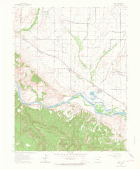
1962 Map of Mack
USGS Topo · Published 1964About this map
The Denver and Rio Grande Western railroad tracks cut a diagonal path across this high desert landscape, connecting the small agricultural and industrial outposts of Mack, Loma, and Gilsonite. This early 1960s survey illustrates a region shaped by complex irrigation efforts, notably the Grand Valley Canal and the Kiefer Extension Grand Valley Canal, which brought water to the arid flats north of the Colorado River. South of the river, the terrain shifts abruptly into a labyrinth of deep sandstone drainages, including Horsethief Canyon, Rattlesnake Canyon, and Pollock Canyon. Industrial activity is evident at the Refinery near Gilsonite and several Gravel Pit operations, while the Old Ute Trail provides a link to the area's pre-settlement history as it winds through the southern canyonlands.
Find a feature on this map
30 named features on this map. Tap any name to fly to it.
Don’t see what you’re looking for? This feature index may not catch every label — zoom into the map to look around manually.
Map Details
Editions of this 1962 Mack Map
3 editions found
Other maps of this area

1934 · Colorado National Monument
USGS Topo · 1:24,000

1956 · Grand Junction
USGS Topo · 1:250,000

1959 · Grand Junction
USGS Topo · 1:250,000

1960 · Grand Junction
USGS Topo · 1:250,000

1962 · Grand Junction
USGS Topo · 1:250,000

1962 · Fruita
USGS Topo · 1:24,000

1962 · Mack
USGS Topo · 1:24,000

1962 · Colorado National Monument
USGS Topo · 1:24,000
1962 · Battleship Rock
USGS Topo · 1:24,000

1964 · Grand Junction
USGS Topo · 1:250,000