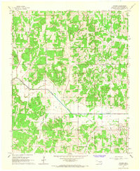
1965 Map of Macomb
USGS Topo · Published 1966About this map
Little River cuts a wide valley through this section of central Oklahoma, anchoring a landscape defined by small-scale farming and the mid-century energy sector. The community of Macomb sits near the eastern edge, while the older footprints of Burnett and Morvin reveal the rural settlement patterns of Pottawatomie County. Local life is anchored by family-named landmarks and rural institutions, including Highland School, Willow View School, and the O K Ch.
Find a feature on this map
24 named features on this map. Tap any name to fly to it.
Don’t see what you’re looking for? This feature index may not catch every label — zoom into the map to look around manually.
Map Details
Editions of this 1965 Macomb Map
3 editions found
Other maps of this area

1896 · Seminole and Prague
USGS Topo · 1:125,000

1898 · Purcell
USGS Topo · 1:125,000

1907 · Maud
USGS Topo · 1:62,500

1908 · Maud
USGS Topo · 1:62,500

1909 · Shawnee
USGS Topo · 1:62,500

1910 · McComb
USGS Topo · 1:62,500

1930 · McLoud
USGS Topo · 1:62,500

1954 · Oklahoma City
USGS Topo · 1:250,000
1956 · Stella
USGS Topo · 1:24,000

1957 · Oklahoma City
USGS Topo · 1:250,000