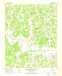
1965 Map of Macomb
USGS Topo · Published 1976About this map
The Little River bisects this landscape of Central Oklahoma, where agriculture and early energy development defined the local economy during the mid-twentieth century. The community of Macomb serves as the primary hub in the southeast, while the hamlet of Morvin sits further north. Rural life is anchored by institutions like the Willow View Sch and Highland Sch, alongside churches and family burial grounds including Mars Hill Cem and Prospect Cem.
Find a feature on this map
23 named features on this map. Tap any name to fly to it.
Don’t see what you’re looking for? This feature index may not catch every label — zoom into the map to look around manually.
Map Details
Editions of this 1965 Macomb Map
3 editions found
Other maps of this area

1896 · Seminole and Prague
USGS Topo · 1:125,000

1898 · Purcell
USGS Topo · 1:125,000

1907 · Maud
USGS Topo · 1:62,500

1908 · Maud
USGS Topo · 1:62,500

1909 · Shawnee
USGS Topo · 1:62,500

1910 · McComb
USGS Topo · 1:62,500

1930 · McLoud
USGS Topo · 1:62,500

1954 · Oklahoma City
USGS Topo · 1:250,000
1956 · Stella
USGS Topo · 1:24,000

1957 · Oklahoma City
USGS Topo · 1:250,000