
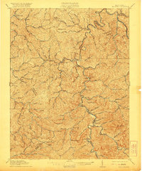
1911 Map of Madison
USGS Topo · Published 1911About this map
The Little Coal River carves through the heart of Boone County, anchoring a landscape defined by its deep hollows and narrow valleys before the major industrial expansions of the mid-20th century. At this time, the Chesapeake and Ohio railroad serves as the primary artery for the region, navigating the difficult terrain via significant engineering works like Blue Tom Tunnel, Sproul Tunnel, and Pinnacle Tunnel.
Find a feature on this map
117 named features on this map. Tap any name to fly to it.
Don’t see what you’re looking for? This feature index may not catch every label — zoom into the map to look around manually.
Map Details
Editions of this 1911 Madison Map
2 editions found
Other maps of this area

1887 · Warfield
USGS Topo · 1:125,000

1891 · Oceana
USGS Topo · 1:125,000

1891 · Warfield
USGS Topo · 1:125,000

1892 · Huntington
USGS Topo · 1:125,000

1893 · Oceana
USGS Topo · 1:125,000

1898 · Huntington
USGS Topo · 1:125,000

1898 · Oceana
USGS Topo · 1:125,000

1899 · Charleston
USGS Topo · 1:125,000

1902 · Milton
USGS Topo · 1:62,500

1902 · Midkiff
USGS Topo · 1:62,500