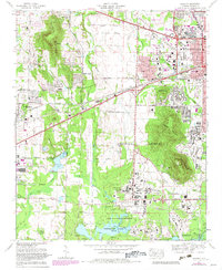
1975 Map of Madison
USGS Topo · Published 1982About this map
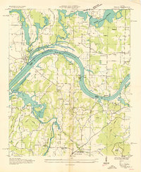
The Marshall Space Flight Center (NASA) and the sprawling grounds of the Redstone Arsenal dominate this 1970s landscape, reflecting the era's intensive aerospace and military activity in Northern Alabama. The transition from rural homesteads to a high-tech hub is evident, with the University of Alabama Huntsville campus expanding near Sherwood Park while traditional family landmarks like Jamar Cem and Royal Cem remain embedded in the terrain. The Southern Railway corridor serves as a primary transit spine, connecting the established center of Madison with the growing residential developments of Skyline Acres and Rainbow Mtn Heights. Along the southern margin, the Wheeler National Wildlife Refuge preserves the natural shoreline of Wheeler Lake, providing a stark contrast to the industrial and academic complexes that define the region's mid-century growth.
Find a feature on this map
70 named features on this map. Tap any name to fly to it.
Don’t see what you’re looking for? This feature index may not catch every label — zoom into the map to look around manually.
Map Details
Editions of this 1975 Madison Map
4 editions found
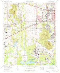
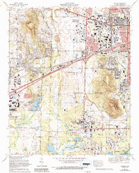
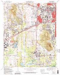
Other maps of this area

1888 · Huntsville
USGS Topo · 1:125,000

1892 · Huntsville
USGS Topo · 1:125,000

1936 · Jeff
USGS Topo · 1:24,000

1936 · Capshaw
USGS Topo · 1:24,000
1936 · Triana
USGS Topo · 1:24,000

1936 · Madison
USGS Topo · 1:24,000

1936 · Meridianville
USGS Topo · 1:24,000

1936 · Mason Ridge
USGS Topo · 1:24,000

1936 · Greenbrier
USGS Topo · 1:24,000

1936 · Farley
USGS Topo · 1:24,000