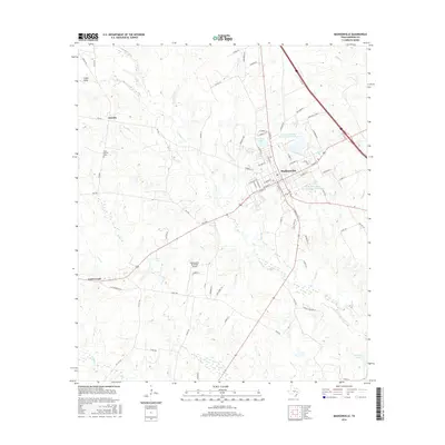
2016 Map of Madisonville
USGS Topo · Published 2016About this map
Madisonville serves as the central hub of this East Texas landscape, where the local street grid intersects with major regional thoroughfares like W Main St and S May St. The surrounding countryside is defined by a dense network of seasonal waterways and creeks, including Mustang Cr, Greenbriar Cr, and Kickapoo Cr, which carve through the terrain. To the west, the settlement of Laceola and the High Prairie Cem provide focal points for local history and genealogy. The infrastructure of the mid-2010s is evident in the presence of the Madisonville Municipal Airport and multiple water management features, such as the Soil Conservation Service Site 1 Reservoir and Crescent Lake. These reservoirs and the scattered ponds near Cottonwood reflect the area's agricultural and conservation focus, while small lakes like Osborne Lake and Stewart Lake dot the rural reaches of the county.
Find a feature on this map
87 named features on this map. Tap any name to fly to it.
Don’t see what you’re looking for? This feature index may not catch every label — zoom into the map to look around manually.
Map Details
Editions of this 2016 Madisonville Map
This is the sole edition of this map. No revisions or reprints were ever made.
Other maps of this area

1931 · Iola
USGS Topo · 1:62,500

1953 · Palestine
USGS Topo · 1:250,000

1954 · Waco
USGS Topo · 1:250,000

1954 · Beaumont
USGS Topo · 1:250,000

1954 · Austin
USGS Topo · 1:250,000

1955 · Waco
USGS Topo · 1:250,000

1957 · Beaumont
USGS Topo · 1:250,000

1957 · Palestine
USGS Topo · 1:250,000

1962 · Connor
USGS Topo · 1:24,000

1963 · Bedias
USGS Topo · 1:24,000