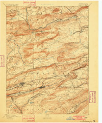
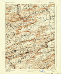
1893 Map of Mahanoy
USGS Topo · Published 1901About this map
The anthracite coal region of Northeast Pennsylvania is defined by intense industrial development and complex rail networks in this late nineteenth-century survey. Heavy infrastructure follows the narrow valleys, with the Philadelphia and Reading Railroad and the Lehigh Valley Railroad competing for access to the rich coal fields. Large mining communities like Shenandoah and Mahanoy City show dense urban grids, while smaller colliery settlements such as William Penn, Lost Creek, and Gilberton are scattered along the tracks.
Find a feature on this map
103 named features on this map. Tap any name to fly to it.
Don’t see what you’re looking for? This feature index may not catch every label — zoom into the map to look around manually.
Map Details
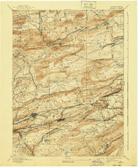
Editions of this 1893 Mahanoy Map
7 editions found

Other maps of this area

1889 · Catawissa
USGS Topo · 1:62,500

1889 · Hazleton
USGS Topo · 1:62,500

1889 · Pottsville
USGS Topo · 1:62,500

1891 · Wilkesbarre
USGS Topo · 1:62,500

1891 · Hazleton
USGS Topo · 1:62,500

1891 · Pottsville
USGS Topo · 1:62,500

1892 · Catawissa
USGS Topo · 1:62,500

1892 · Mahanoy
USGS Topo · 1:62,500

1892 · Pine Grove
USGS Topo · 1:62,500

1893 · Hazleton
USGS Topo · 1:62,500