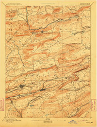
1893 Map of Mahanoy
USGS Topo · Published 1910About this map
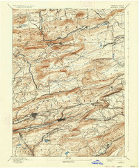
Shenandoah and Mahanoy City anchor this industrial landscape during the late nineteenth-century peak of Pennsylvania anthracite production. The map reveals a complex web of transport infrastructure required to move coal from the mountains to market, including the Philadelphia and Reading Railroad and the Lehigh Valley Railroad. These lines wind through the high ridges of Mahanoy Mountain and Locust Mountain, connecting coal patches and company towns. The dense network of spurs and junctions, such as Delano Junction and Quakake Junction, illustrates the competitive nature of the regional rail economy. Beyond the mines, smaller agricultural and residential settlements like Ringtown and New London (Nuremberg) occupy the valleys, while reservoirs like the Silver Creek Reservoir highlight the region's managed water resources. This survey captures the height of a dominant extraction era before mid-twentieth-century industrial shifts transformed the valley.
Find a feature on this map
106 named features on this map. Tap any name to fly to it.
Don’t see what you’re looking for? This feature index may not catch every label — zoom into the map to look around manually.
Map Details
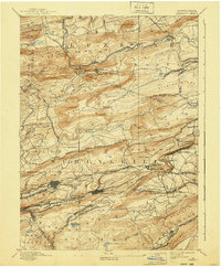
Editions of this 1893 Mahanoy Map
7 editions found

Other maps of this area

1889 · Catawissa
USGS Topo · 1:62,500

1889 · Hazleton
USGS Topo · 1:62,500

1889 · Pottsville
USGS Topo · 1:62,500

1891 · Wilkesbarre
USGS Topo · 1:62,500

1891 · Hazleton
USGS Topo · 1:62,500

1891 · Pottsville
USGS Topo · 1:62,500

1892 · Catawissa
USGS Topo · 1:62,500

1892 · Mahanoy
USGS Topo · 1:62,500

1892 · Pine Grove
USGS Topo · 1:62,500

1893 · Hazleton
USGS Topo · 1:62,500