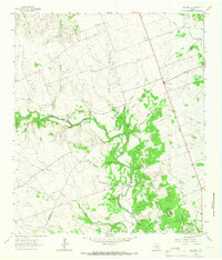
1964 Map of Mahomet
USGS Topo · Published 1966About this map
Mahomet and the surrounding Hill Country ranch land are detailed in this mid-1960s survey along the Burnet and Williamson county line. The landscape is defined by the winding course of the North Fork San Gabriel River and its numerous tributaries, including Ramsey Branch and Bertram Branch. For the local historian, the map provides a look at the scattered rural communities of the era, such as Gabriel Mills and Sycamore Springs, alongside established landmarks like Greens Crossing. The map is particularly useful for genealogists, as it identifies several burial grounds including Mahomet Cem, Mt Horeb Cem, and Gabriel Mills Cem. Natural landmarks like Bald Knob, Pilot Knob, and Cedar Bluff stand out against the numerous gravel pits that hint at the local mineral industry during this period of Texas history.
Find a feature on this map
41 named features on this map. Tap any name to fly to it.
Don’t see what you’re looking for? This feature index may not catch every label — zoom into the map to look around manually.
Map Details
Editions of this 1964 Mahomet Map
2 editions found
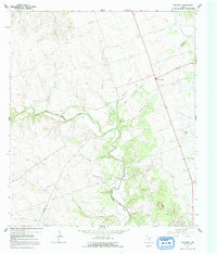
Other maps of this area

1887 · Burnet
USGS Topo · 1:125,000

1893 · Georgetown
USGS Topo · 1:125,000

1893 · Burnet
USGS Topo · 1:125,000

1903 · Burnet
USGS Topo · 1:125,000

1909 · Burnet
USGS Topo · 1:125,000

1932 · Bertram
USGS Topo · 1:62,500

1954 · Llano
USGS Topo · 1:250,000

1954 · Austin
USGS Topo · 1:250,000

1955 · Llano
USGS Topo · 1:250,000

1956 · Llano
USGS Topo · 1:250,000