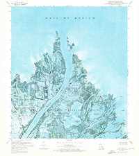
1971 Map of Main Pass
USGS Topo · Published 1974About this map
Delta National Wildlife Refuge dominates this coastal landscape, where the freshwater outflow of the Mississippi River delta meets the Gulf of Mexico. This 1971 orthophotomap provides a unique visual record of the fragile marshland geography, showing the intricate network of splay deposits and sediment-rich waterways that define the region. Industrial activity is woven directly into the conservation area, evidenced by the Romere Oil and Gas Field and the Delta Duck Oil Field, which are marked by numerous oil wells, pipelines, and sludge pits. Named water bodies such as Main Pass and Romere Pass serve as primary arterial channels, while dozens of family-named or descriptive ponds like Bennies Pond, Gauthier Pond, and Speckled Goose Pond illustrate the fine-grained local nomenclature of the Plaquemines Parish wetlands.
Find a feature on this map
69 named features on this map. Tap any name to fly to it.
Don’t see what you’re looking for? This feature index may not catch every label — zoom into the map to look around manually.
Map Details
Editions of this 1971 Main Pass Map
2 editions found
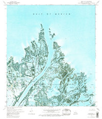
Other maps of this area

1893 · East Delta
USGS Topo · 1:62,500

1893 · Forts
USGS Topo · 1:62,500

1893 · West Delta
USGS Topo · 1:62,500

1935 · Taylor Pass
USGS Topo · 1:31,680

1947 · Pass A Loutre West
USGS Topo · 1:31,680

1947 · Venice
USGS Topo · 1:31,680

1947 · Main Pass
USGS Topo · 1:31,680

1947 · Pass A Loutre East
USGS Topo · 1:31,680

1948 · Forts
USGS Topo · 1:62,500

1949 · Cubits Gap
USGS Topo · 1:31,680