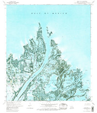
1971 Map of Main Pass
USGS Topo · Published 1974About this map
Delta National Wildlife Refuge dominates this coastal landscape, protecting a complex network of wetlands and open water at the mouth of the Mississippi River delta. The 1971 survey illustrates the precarious balance between natural conservation and industrial extraction, with the Rowere Pass Oil and Gas Field and Delta Dock Oil Field situated directly alongside sensitive marshes. These industrial sites are marked by numerous sludge pits and oil wells, indicating the intensive energy production occurring within the delta during the early 1970s.
Find a feature on this map
69 named features on this map. Tap any name to fly to it.
Don’t see what you’re looking for? This feature index may not catch every label — zoom into the map to look around manually.
Map Details
Editions of this 1971 Main Pass Map
2 editions found
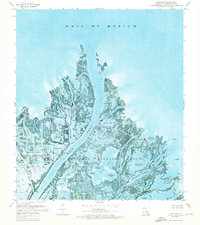
Other maps of this area

1893 · East Delta
USGS Topo · 1:62,500

1893 · Forts
USGS Topo · 1:62,500

1893 · West Delta
USGS Topo · 1:62,500

1935 · Taylor Pass
USGS Topo · 1:31,680

1947 · Pass A Loutre West
USGS Topo · 1:31,680

1947 · Venice
USGS Topo · 1:31,680

1947 · Main Pass
USGS Topo · 1:31,680

1947 · Pass A Loutre East
USGS Topo · 1:31,680

1948 · Forts
USGS Topo · 1:62,500

1949 · Cubits Gap
USGS Topo · 1:31,680