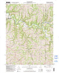
1997 Map of Majorsville
USGS Topo · Published 2000About this map
The Marshall and Greene county lines define the eastern edge of this northern West Virginia landscape, where the rugged topography of Sand Hill and Webster districts is carved by the Wheeling Creek watershed. The settlement pattern follows the high ground of Lone Oak Ridge and Dodds Ridge, with small communities like Majorsville and Beelers Station serving as local anchors.
Find a feature on this map
64 named features on this map. Tap any name to fly to it.
Don’t see what you’re looking for? This feature index may not catch every label — zoom into the map to look around manually.
Map Details
Editions of this 1997 Majorsville Map
This is the sole edition of this map. No revisions or reprints were ever made.
Other maps of this area

1902 · Wheeling
USGS Topo · 1:62,500

1904 · Cameron
USGS Topo · 1:62,500

1905 · Rogersville
USGS Topo · 1:62,500

1907 · Claysville
USGS Topo · 1:62,500

1935 · Cameron
USGS Topo · 1:62,500

1935 · Wheeling
USGS Topo · 1:62,500

1942 · Cameron
USGS Topo · 1:62,500

1942 · Wheeling
USGS Topo · 1:62,500

1949 · Clarksburg
USGS Topo · 1:250,000

1951 · Canton
USGS Topo · 1:250,000