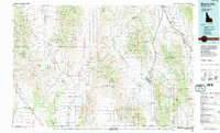
1984 Map of Malad City
USGS Topo · Published 1984About this map
Malad City serves as the focal point of this topographic study, situated where the Malad Valley meets the rising elevations of the Malad Range. The landscape is a complex arrangement of high-desert basins and mountain corridors, including the Curlew National Grassland and the Deep Creek Mountains. The transportation network is defined by Interstate 15 and the Union Pacific railroad, tracing the natural north-south route through the valley. Smaller agricultural settlements like Samaria and Holbrook anchor the rural landscape, with the Samaria Cem providing a specific point of interest for genealogists. Water management is evident through features like the Devil Creek Reservoir and Weston Creek Reservoir, which support the region's ranching and farming operations. The map also delineates the state boundary between Idaho and Utah, showing the northernmost reaches of the Pocatello Valley.
Find a feature on this map
54 named features on this map. Tap any name to fly to it.
Don’t see what you’re looking for? This feature index may not catch every label — zoom into the map to look around manually.
Map Details
Editions of this 1984 Malad City Map
2 editions found
Other maps of this area

1914 · Logan
USGS Topo · 1:125,000

1915 · Preston
USGS Topo · 1:96,000

1916 · Logan
USGS Topo · 1:125,000

1918 · Preston
USGS Topo · 1:125,000

1934 · Rockland
USGS Topo · 1:62,500

1937 · Rockland
USGS Topo · 1:62,500

1938 · Pauline
USGS Topo · 1:48,000

1944 · Arbon
USGS Topo · 1:62,500

1948 · Bancroft
USGS Topo · 1:62,500

1949 · Bancroft
USGS Topo · 1:62,500