
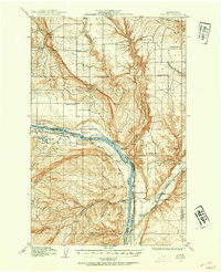
1912 Map of Malaga
USGS Topo · Published 1912About this map
The Columbia River carves a deep path through the landscape of central Washington, separating Chelan and Douglas counties as it flows past Malaga. This 1912 survey captures the region during a period of agricultural and educational expansion, evidenced by the dense distribution of local schoolhouses. From the East Wenatchee School in the north to the Rocky Point School and Valhalla School further south, these institutions served as the primary social anchors for scattered homesteads.
Find a feature on this map
28 named features on this map. Tap any name to fly to it.
Don’t see what you’re looking for? This feature index may not catch every label — zoom into the map to look around manually.
Map Details
Editions of this 1912 Malaga Map
2 editions found
Other maps of this area

1901 · Chelan
USGS Topo · 1:125,000

1909 · Quincy
USGS Topo · 1:62,500

1910 · Quincy
USGS Topo · 1:62,500

1913 · Wenatchee
USGS Topo · 1:62,500

1914 · Malaga
USGS Topo · 1:62,500

1915 · Wenatchee
USGS Topo · 1:62,500

1920 · Colockum Pass
USGS Topo · 1:125,000

1922 · Colockum Pass
USGS Topo · 1:125,000

1953 · Ritzville
USGS Topo · 1:250,000

1957 · Wenatchee
USGS Topo · 1:250,000