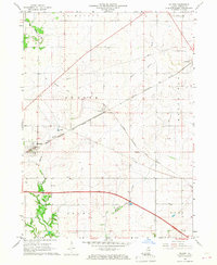
1966 Map of Malden
USGS Topo · Published 1967About this map
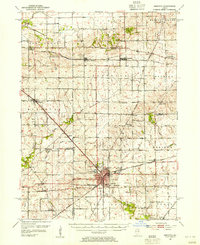
Malden and the neighboring rail settlements of Arlington and Zearing anchor this mid-1960s topographic study of Bureau County. The landscape is defined by the heavy infrastructure of the Chicago Burlington and Quincy railroad, which runs diagonally across the township lines of Berlin and Westfield. Evidence of older transportation routes persists in the form of an Old Railroad Grade north of Malden, reflecting the evolving rail network of north-central Illinois.
Find a feature on this map
19 named features on this map. Tap any name to fly to it.
Don’t see what you’re looking for? This feature index may not catch every label — zoom into the map to look around manually.
Map Details
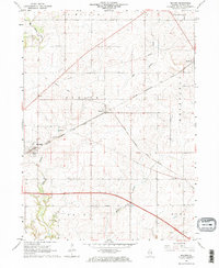
Editions of this 1966 Malden Map
2 editions found
Other maps of this area

1893 · Hennepin
USGS Topo · 1:62,500

1893 · Lasalle
USGS Topo · 1:62,500

1909 · Hennepin
USGS Topo · 1:62,500

1911 · La Salle
USGS Topo · 1:62,500

1911 · Hennepin
USGS Topo · 1:62,500

1913 · La Salle
USGS Topo · 1:62,500
1947 · La Salle
USGS Topo · 1:62,500
1951 · Amboy
USGS Topo · 1:62,500
1952 · Mendota
USGS Topo · 1:62,500

1958 · Aurora
USGS Topo · 1:250,000