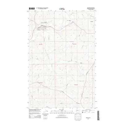
2014 Map of Malden
USGS Topo · Published 2014About this map
Malden and Rosalia anchor this portion of the Palouse, where the rolling agricultural landscape is defined by the drainage patterns of Pine Cr and Cache Cr. The grid of the township and range system is clearly visible, overlaid with a network of rural routes such as Malden Rd and Old Thornton Hwy. This 2014 representation captures the area's rural character, showing the concentration of residential blocks in the town of Malden in contrast to the surrounding open fields and scattered farmstead access roads. Watercourses like Thorn Cr and Willow Cr cut through the terrain, illustrating the natural drainage that supports the region's dryland farming heritage.
Find a feature on this map
2 named features on this map. Tap any name to fly to it.
Don’t see what you’re looking for? This feature index may not catch every label — zoom into the map to look around manually.
Map Details
Editions of this 2014 Malden Map
This is the sole edition of this map. No revisions or reprints were ever made.
Other maps of this area

1903 · Oakesdale
USGS Topo · 1:125,000

1905 · Oakesdale
USGS Topo · 1:125,000

1954 · Cheney
USGS Topo · 1:62,500

1954 · Spangle
USGS Topo · 1:62,500

1955 · Spokane
USGS Topo · 1:250,000

1958 · Spokane
USGS Topo · 1:250,000

1964 · St. John
USGS Topo · 1:24,000

1964 · Malden
USGS Topo · 1:24,000
1964 · Steptoe
USGS Topo · 1:24,000
1964 · Rosalia
USGS Topo · 1:24,000