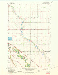
1963 Map of Mallory
USGS Topo · Published 1982About this map
Red Lake River meanders sharply through the flat plains of Polk County, defining the landscape alongside its tributary, Grand Marais Creek. This early 1960s survey, updated in the mid-1970s, captures a rural region structured by the townships of Sullivan, Huntsville, Rhinehart, and Grand Forks. The settlement at Mallory serves as a focal point along the Great Northern Pacific railroad, which cuts diagonally across the southern portion of the quadrangle.
Find a feature on this map
20 named features on this map. Tap any name to fly to it.
Don’t see what you’re looking for? This feature index may not catch every label — zoom into the map to look around manually.
Map Details
Editions of this 1963 Mallory Map
3 editions found
Other maps of this area

1918 · Warren
USGS Topo · 1:62,500

1934 · Grand Forks
USGS Topo · 1:24,000

1934 · Grand Forks
USGS Topo · 1:62,500

1938 · Grand Forks
USGS Topo · 1:62,500

1952 · Grand Forks
USGS Topo · 1:250,000

1952 · Thief River Falls
USGS Topo · 1:250,000

1955 · Warren
USGS Topo · 1:62,500

1956 · Thief River Falls
USGS Topo · 1:250,000

1956 · Grand Forks
USGS Topo · 1:250,000

1957 · Thief River Falls
USGS Topo · 1:250,000