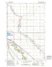
1963 Map of Mallory
USGS Topo · Published 1995About this map
The winding course of the Red Lake River and Grand Marais Creek dominates this Red River Valley landscape, illustrating the critical role of water management in Polk County's agricultural history. The map shows an extensive network of drainage infrastructure, including County Ditch No 88 and County Ditch No 126, which transformed the fertile prairie for farming. Small rural centers and educational hubs such as Mallory and Driscoll Sch reflect the settlement patterns of the mid-20th century.
Find a feature on this map
22 named features on this map. Tap any name to fly to it.
Don’t see what you’re looking for? This feature index may not catch every label — zoom into the map to look around manually.
Map Details
Editions of this 1963 Mallory Map
3 editions found
Other maps of this area

1918 · Warren
USGS Topo · 1:62,500

1934 · Grand Forks
USGS Topo · 1:24,000

1934 · Grand Forks
USGS Topo · 1:62,500

1938 · Grand Forks
USGS Topo · 1:62,500

1952 · Grand Forks
USGS Topo · 1:250,000

1952 · Thief River Falls
USGS Topo · 1:250,000

1955 · Warren
USGS Topo · 1:62,500

1956 · Thief River Falls
USGS Topo · 1:250,000

1956 · Grand Forks
USGS Topo · 1:250,000

1957 · Thief River Falls
USGS Topo · 1:250,000