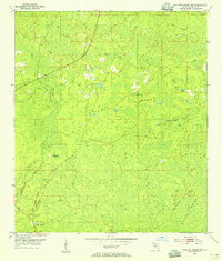
1954 Map of Mallory Swamp NW
USGS Topo · Published 1955About this map
Mallory Swamp dominates this interior portion of Lafayette County, revealing a landscape defined by an intricate network of wetlands, bays, and ridges during the mid-1950s. The topographic detail highlights the transition from the dense Brushy Hammock to the slightly higher ground of Driggers Ridge, punctuated by numerous isolated water bodies such as Rattlesnake Pond and Board Bay.
Find a feature on this map
20 named features on this map. Tap any name to fly to it.
Don’t see what you’re looking for? This feature index may not catch every label — zoom into the map to look around manually.
Map Details
Editions of this 1954 Mallory Swamp NW Map
3 editions found
Other maps of this area

1954 · Mallory Swamp NW
USGS Topo · 1:24,000

1954 · Day SE
USGS Topo · 1:24,000

1954 · Clara
USGS Topo · 1:24,000

1954 · Mallory Swamp SW
USGS Topo · 1:24,000

1954 · Cooks Hammock
USGS Topo · 1:24,000

1954 · Mallory Swamp SE
USGS Topo · 1:24,000

1954 · Mallory Swamp NE
USGS Topo · 1:24,000

1954 · Gainesville
USGS Topo · 1:250,000

1954 · Valdosta
USGS Topo · 1:250,000

1955 · Mayo
USGS Topo · 1:24,000