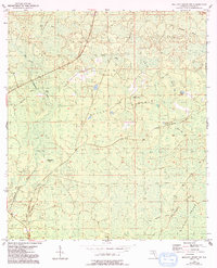
1954 Map of Mallory Swamp NW
USGS Topo · Published 1993About this map
Mallory Swamp and its complex network of seasonal wetlands dominate this portion of Lafayette County, as documented in the mid-1950s. The landscape is a mosaic of dense bays and hammocks, including Still Bay, Bear Bay, and the prominent Brushy Hammock. These features illustrate the natural hydrology of the Florida interior before major modern drainage alterations, where water moved slowly through systems like Wolf Creek toward the Steinhatchee River.
Find a feature on this map
18 named features on this map. Tap any name to fly to it.
Don’t see what you’re looking for? This feature index may not catch every label — zoom into the map to look around manually.
Map Details
Editions of this 1954 Mallory Swamp NW Map
3 editions found
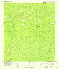
Other maps of this area

1954 · Mallory Swamp NW
USGS Topo · 1:24,000

1954 · Day SE
USGS Topo · 1:24,000

1954 · Clara
USGS Topo · 1:24,000

1954 · Mallory Swamp SW
USGS Topo · 1:24,000

1954 · Cooks Hammock
USGS Topo · 1:24,000

1954 · Mallory Swamp SE
USGS Topo · 1:24,000

1954 · Mallory Swamp NE
USGS Topo · 1:24,000

1954 · Gainesville
USGS Topo · 1:250,000

1954 · Valdosta
USGS Topo · 1:250,000

1955 · Mayo
USGS Topo · 1:24,000