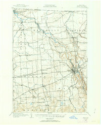
1915 Map of Malone
USGS Topo · Published 1963About this map
Malone serves as the industrial and transit hub for this Franklin County region, situated at the confluence of the Adirondack Division New York Central Railroad and the Rutland Railroad. The town’s position along the Salmon River and its concentration of rail infrastructure, including Malone Junction, stand in contrast to the agricultural landscape of northern New York during the early twentieth century. Beyond the rail yards, the map documents a dense network of one-room district schools and scattered rural hamlets like Westville and Cooks Corner.
Find a feature on this map
56 named features on this map. Tap any name to fly to it.
Don’t see what you’re looking for? This feature index may not catch every label — zoom into the map to look around manually.
Map Details
Editions of this 1915 Malone Map
2 editions found
Other maps of this area

1906 · Loon Lake
USGS Topo · 1:62,500

1908 · Loon Lake
USGS Topo · 1:62,500

1915 · Chateaugay
USGS Topo · 1:62,500

1915 · Malone
USGS Topo · 1:62,500

1915 · Moira
USGS Topo · 1:62,500

1917 · Malone
USGS Topo · 1:62,500

1917 · Moira
USGS Topo · 1:62,500

1919 · Nicholville
USGS Topo · 1:62,500

1921 · Nicholville
USGS Topo · 1:62,500

1921 · Santa Clara
USGS Topo · 1:62,500