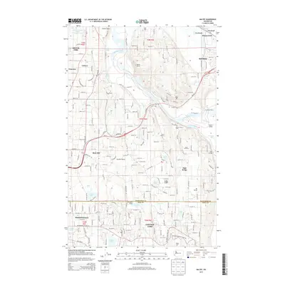
2014 Map of Maltby
USGS Topo · Published 2014About this map
The Snohomish River forms at the confluence of the Snoqualmie River and Skykomish River in the northeastern corner of this study, creating a complex hydrologic network of sloughs and lakes. This 2014 survey documents the expanding residential and agricultural footprint between Monroe and Woodinville, where established communities like Maltby and Cottage Lake are defined by the transition from river valley to upland plateaus.
Find a feature on this map
54 named features on this map. Tap any name to fly to it.
Don’t see what you’re looking for? This feature index may not catch every label — zoom into the map to look around manually.
Map Details
Editions of this 2014 Maltby Map
This is the sole edition of this map. No revisions or reprints were ever made.
Other maps of this area

1895 · Snohomish
USGS Topo · 1:125,000

1897 · Seattle
USGS Topo · 1:125,000

1921 · Sultan
USGS Topo · 1:125,000

1923 · Sultan
USGS Topo · 1:125,000

1944 · Everett
USGS Topo · 1:62,500

1950 · Redmond
USGS Topo · 1:24,000

1950 · Kirkland
USGS Topo · 1:24,000

1953 · Monroe
USGS Topo · 1:24,000
1953 · Bothell
USGS Topo · 1:24,000
1953 · Maltby
USGS Topo · 1:24,000