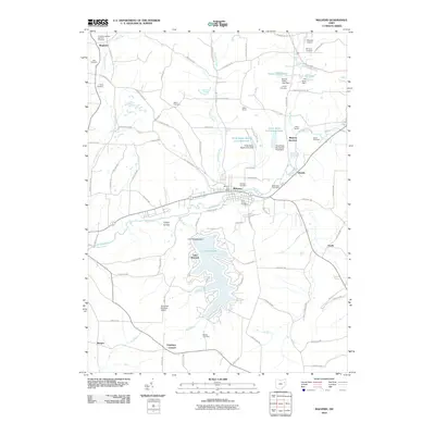
2010 Map of Malvern
USGS Topo · Published 2010About this map
Lake Mohawk dominates the southern landscape of this Carroll County survey, its irregular shoreline defined by the Lake Mohawk Dam and numerous surrounding residential roads like Citrus Rd NW. The village of Malvern serves as a central hub, situated where Armstrong Run meets Sandy Creek. This area is particularly dense with genealogical sites, featuring numerous burial grounds such as Saint Xavier Cemetery, Hardesty Cemetery, and Bethlehem Cemetery. To the north and east, the map reveals a mosaic of smaller settlements and community landmarks including Oneida, Minerva Junction, and the YMCA Camp. The terrain transitions from the broader valley floors near Turkey Hollow to the more developed corridors supporting local aviation at the Minerva Airport and the Schneider-Mohawk Airport.
Find a feature on this map
90 named features on this map. Tap any name to fly to it.
Don’t see what you’re looking for? This feature index may not catch every label — zoom into the map to look around manually.
Map Details
Editions of this 2010 Malvern Map
This is the sole edition of this map. No revisions or reprints were ever made.
Other maps of this area

1901 · Canton
USGS Topo · 1:62,500

1903 · Canton
USGS Topo · 1:62,500

1909 · Alliance
USGS Topo · 1:62,500

1910 · Carrollton
USGS Topo · 1:62,500

1912 · Dover
USGS Topo · 1:62,500

1912 · Carrollton
USGS Topo · 1:62,500

1944 · Dover
USGS Topo · 1:62,500

1951 · Canton
USGS Topo · 1:250,000

1953 · Canton
USGS Topo · 1:250,000

1957 · Canton
USGS Topo · 1:250,000