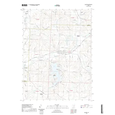
2019 Map of Malvern
USGS Topo · Published 2019About this map
Sandy Creek flows through the center of this landscape, anchoring a valley where the settlements of Malvern, Oneida, and Minerva Junction developed along established transport routes. The region is marked by a dense concentration of historical burial grounds, including the Bethlehem Cem and Saint Xavier Cem, providing a detailed record of the families who settled this corner of Carroll and Stark Counties. In the southern portion of the quadrangle, the large expanse of Lake Mohawk and its surrounding residential infrastructure represent a significant modern alteration to the natural drainage of Middle Run. Local aviation history is represented by the Minerva Airport and Furey Airport. From the crossroads at Fritchleys Corners to the terrain at Turkey Hollow, the map documents the persistent rural character of these Ohio townships, even as residential footprints like Leyda and Morges maintain their historic place on the land.
Find a feature on this map
140 named features on this map. Tap any name to fly to it.
Don’t see what you’re looking for? This feature index may not catch every label — zoom into the map to look around manually.
Map Details
Editions of this 2019 Malvern Map
This is the sole edition of this map. No revisions or reprints were ever made.
Other maps of this area

1901 · Canton
USGS Topo · 1:62,500

1903 · Canton
USGS Topo · 1:62,500

1909 · Alliance
USGS Topo · 1:62,500

1910 · Carrollton
USGS Topo · 1:62,500

1912 · Dover
USGS Topo · 1:62,500

1912 · Carrollton
USGS Topo · 1:62,500

1944 · Dover
USGS Topo · 1:62,500

1951 · Canton
USGS Topo · 1:250,000

1953 · Canton
USGS Topo · 1:250,000

1957 · Canton
USGS Topo · 1:250,000