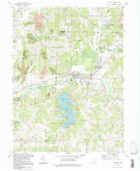
1994 Map of Malvern
USGS Topo · Published 1998About this map
Lake Mohawk dominates the central landscape of this eastern Ohio survey, situated where the Geographers Line divides the Congress Lands from the Old Seven Ranges. The settlement at Malvern serves as a local hub, situated at the confluence where Middle Run meets Sandy Creek. To the west, Waynesburg borders the Stark and Carroll County line, while smaller locales like Fritchleys Corners and Morges dot the southern reaches of Rose and Harrison townships.
Find a feature on this map
48 named features on this map. Tap any name to fly to it.
Don’t see what you’re looking for? This feature index may not catch every label — zoom into the map to look around manually.
Map Details
Editions of this 1994 Malvern Map
This is the sole edition of this map. No revisions or reprints were ever made.
Other maps of this area

1901 · Canton
USGS Topo · 1:62,500

1903 · Canton
USGS Topo · 1:62,500

1909 · Alliance
USGS Topo · 1:62,500

1910 · Carrollton
USGS Topo · 1:62,500

1912 · Dover
USGS Topo · 1:62,500

1912 · Carrollton
USGS Topo · 1:62,500

1944 · Dover
USGS Topo · 1:62,500

1951 · Canton
USGS Topo · 1:250,000

1953 · Canton
USGS Topo · 1:250,000

1957 · Canton
USGS Topo · 1:250,000