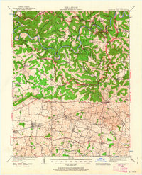
1922 Map of Mammoth Cave
USGS Topo · Published 1963About this map
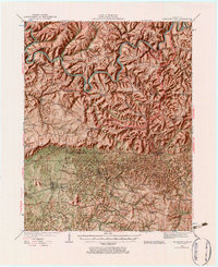
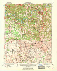
Mammoth Cave National Park dominates the northern half of this landscape, carved by the winding paths of the Green River and Nollin River. The subterranean complexity of the region is evident through numerous named karst features like Great Onyx Cave, Crystal Cave, and Colossal Cave, as well as unique depressions such as Cedar Sink and Monroe Sink. Before modern bridges simplified travel, a network of river crossings including Webb Ferry, Houchins Ferry, and the Fishtrap Ferry connected isolated settlements like Cade and Arthur. To the south, the terrain levels out near the Louisville and Nashville Road, where agricultural communities such as Smiths Grove and Park City flourished. The density of rural infrastructure is remarkable, with numerous local institutions such as Stony Point School, Maple Spring School, and Dripping Spring Church serving a dispersed population at the time of the initial survey.
Find a feature on this map
109 named features on this map. Tap any name to fly to it.
Don’t see what you’re looking for? This feature index may not catch every label — zoom into the map to look around manually.
Map Details
Editions of this 1922 Mammoth Cave Map
7 editions found
Other maps of this area

1921 · Bowling Green
USGS Topo · 1:62,500

1922 · Leitchfield
USGS Topo · 1:48,000

1922 · Brownsville
USGS Topo · 1:62,500

1922 · Mammoth Cave
USGS Topo · 1:62,500

1923 · Bowling Green
USGS Topo · 1:62,500

1923 · Mammoth Cave
USGS Topo · 1:62,500

1923 · Brownsville
USGS Topo · 1:62,500

1925 · Cub Run
USGS Topo · 1:62,500

1925 · Leitchfield
USGS Topo · 1:62,500

1926 · Scottsville
USGS Topo · 1:62,500