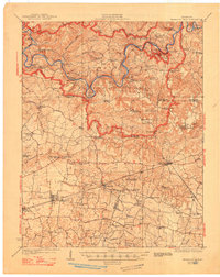
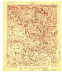
1923 Map of Mammoth Cave
USGS Topo · Published 1948About this map
Mammoth Cave National Park dominates this landscape along the winding Green River in central Kentucky. This survey records the region's complex karst topography and river-based transport network just as it was being federally protected. The terrain is defined by deep sinkholes and hollows, such as Hunts Sink and Cedar Sink, alongside famous subterranean landmarks like Great Onyx Cave and Colossal Cave.
Find a feature on this map
100 named features on this map. Tap any name to fly to it.
Don’t see what you’re looking for? This feature index may not catch every label — zoom into the map to look around manually.
Map Details
Editions of this 1923 Mammoth Cave Map
6 editions found
Other maps of this area

1921 · Bowling Green
USGS Topo · 1:62,500

1922 · Leitchfield
USGS Topo · 1:48,000

1922 · Brownsville
USGS Topo · 1:62,500

1922 · Mammoth Cave
USGS Topo · 1:62,500

1923 · Bowling Green
USGS Topo · 1:62,500

1923 · Mammoth Cave
USGS Topo · 1:62,500

1923 · Brownsville
USGS Topo · 1:62,500

1925 · Cub Run
USGS Topo · 1:62,500

1925 · Leitchfield
USGS Topo · 1:62,500

1926 · Scottsville
USGS Topo · 1:62,500