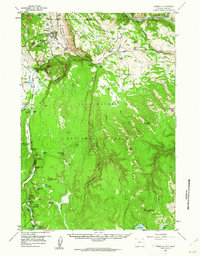
1958 Map of Mammoth
USGS Topo · Published 1962About this map
Mammoth Hot Springs serves as the focal point of this mid-century survey, showcasing the concentration of park infrastructure near the Montana Wyoming border. The map documents the layout of the park headquarters at Mammoth, including F. Mammoth and a local Cem, alongside essential water management features like a Gaging Sta on the Gardner River. The road system, including the Loop Road and the Gardners Hole Road, highlights the established tourist routes of the era, while the Howard Eaton Trail and several Pack Trails indicate the extensive backcountry access preserved for wilderness travel.
Find a feature on this map
97 named features on this map. Tap any name to fly to it.
Don’t see what you’re looking for? This feature index may not catch every label — zoom into the map to look around manually.
Map Details
Editions of this 1958 Mammoth Map
4 editions found
Other maps of this area

1885 · Gallatin
USGS Topo · 1:125,000

1885 · Gallatin
USGS Topo · 1:125,000

1886 · Canyon
USGS Topo · 1:125,000

1891 · Livingston
USGS Topo · 1:250,000

1893 · Livingston
USGS Topo · 1:250,000

1895 · Canyon
USGS Topo · 1:125,000

1896 · Canyon
USGS Topo · 1:125,000

1901 · Canyon
USGS Topo · 1:125,000

1901 · Gallatin
USGS Topo · 1:125,000

1907 · Canyon
USGS Topo · 1:125,000