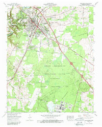
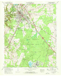
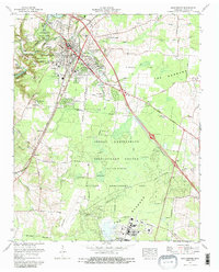
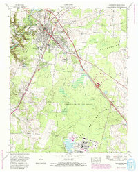
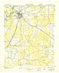
1972 Map of Manchester
USGS Topo · Published 1987About this map
The Old Stone Fort State Park highlights the confluence of the Duck River and Little Duck River, where prehistoric earthworks meet the modern expansion of Manchester. This 1972 revision illustrates a community in transition, with established neighborhoods like Westwood Homes and Royal Oaks bordering the massive Arnold Engineering Development Center. The southern portion of the map is dominated by the Wildlife Management Area and the unique ecological landscape of The Barrens, interspersed with isolated water features such as Sinking Pond and Lemm Swamp.
Find a feature on this map
69 named features on this map. Tap any name to fly to it.
Don’t see what you’re looking for? This feature index may not catch every label — zoom into the map to look around manually.
Map Details
Editions of this 1972 Manchester Map
4 editions found
Other maps of this area

1893 · Mc Minnville
USGS Topo · 1:125,000

1895 · Mc Minnville
USGS Topo · 1:125,000

1895 · Sewanee
USGS Topo · 1:125,000

1913 · Hollow Springs
USGS Topo · 1:62,500

1936 · Ovoca
USGS Topo · 1:24,000

1936 · Alto
USGS Topo · 1:24,000

1936 · Fredonia
USGS Topo · 1:24,000
1936 · Manchester
USGS Topo · 1:24,000

1936 · Noah
USGS Topo · 1:24,000
1936 · Morrison
USGS Topo · 1:24,000