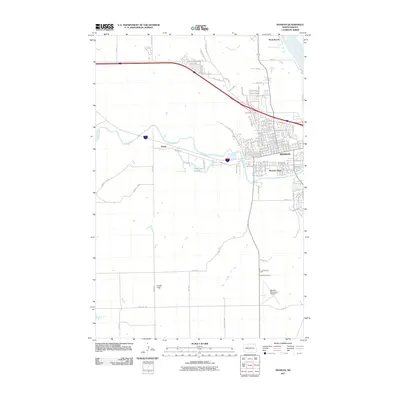
2011 Map of Mandan
USGS Topo · Published 2011About this map
The Missouri River and the Heart River define the landscape of this 2011 survey, converging near the growing city of Mandan. The map reveals a transition from the structured residential blocks of Meadow Park and the main city center to the wide-open terrain of Custer Flats to the southwest. Transportation routes are a primary focus, showcasing the path of the Old Red Trl as it moves north of the river, alongside modern infrastructure like the Mandan Municipal Airport.
Find a feature on this map
100 named features on this map. Tap any name to fly to it.
Don’t see what you’re looking for? This feature index may not catch every label — zoom into the map to look around manually.
Map Details
Editions of this 2011 Mandan Map
This is the sole edition of this map. No revisions or reprints were ever made.
Other maps of this area

1907 · Bismarck
USGS Topo · 1:125,000

1950 · Bismarck
USGS Topo · 1:24,000

1951 · Bismarck
USGS Topo · 1:62,500

1951 · Mandan
USGS Topo · 1:24,000

1954 · Bismarck
USGS Topo · 1:250,000

1958 · Bismarck
USGS Topo · 1:250,000

1962 · Schmidt
USGS Topo · 1:24,000

1962 · Bismarck
USGS Topo · 1:24,000

1962 · Harmon
USGS Topo · 1:24,000
1962 · Burnt Butte
USGS Topo · 1:24,000