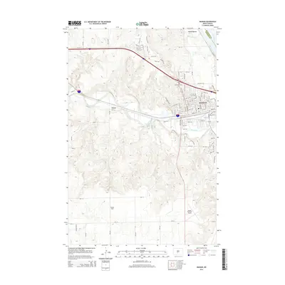
2014 Map of Mandan
USGS Topo · Published 2014About this map
The Missouri River serves as the eastern boundary for this region, meeting the Heart River as it winds through the city of Mandan. This 2014 survey documents the modern layout of the city, showing a dense network of streets such as Main St W and Boundary St NW alongside industrial and transportation corridors. To the west, the settlement of Sunny sits along the rail line, while the northern reaches include the community of Rock Haven near the banks of Rock Haven Cr.
Find a feature on this map
48 named features on this map. Tap any name to fly to it.
Don’t see what you’re looking for? This feature index may not catch every label — zoom into the map to look around manually.
Map Details
Editions of this 2014 Mandan Map
This is the sole edition of this map. No revisions or reprints were ever made.
Other maps of this area

1907 · Bismarck
USGS Topo · 1:125,000

1950 · Bismarck
USGS Topo · 1:24,000

1951 · Bismarck
USGS Topo · 1:62,500

1951 · Mandan
USGS Topo · 1:24,000

1954 · Bismarck
USGS Topo · 1:250,000

1958 · Bismarck
USGS Topo · 1:250,000

1962 · Schmidt
USGS Topo · 1:24,000

1962 · Bismarck
USGS Topo · 1:24,000

1962 · Harmon
USGS Topo · 1:24,000
1962 · Burnt Butte
USGS Topo · 1:24,000