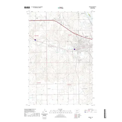
2020 Map of Mandan
USGS Topo · Published 2020About this map
The confluence of the Missouri River and Heart River defines the landscape of this western North Dakota quadrangle. In the city of Mandan, a dense grid of streets including Division St NW and W Main St gives way to the industrial and transportation infrastructure of the 21st century. The map records several vital aviation sites, from the established Mandan Municipal Airport in the southeast to the Landels Airstrip near the northern boundary. Settlement patterns are further marked by Saint Josephs Cem and the small community of Sunny.
Find a feature on this map
59 named features on this map. Tap any name to fly to it.
Don’t see what you’re looking for? This feature index may not catch every label — zoom into the map to look around manually.
Map Details
Editions of this 2020 Mandan Map
This is the sole edition of this map. No revisions or reprints were ever made.
Other maps of this area

1907 · Bismarck
USGS Topo · 1:125,000

1950 · Bismarck
USGS Topo · 1:24,000

1951 · Bismarck
USGS Topo · 1:62,500

1951 · Mandan
USGS Topo · 1:24,000

1954 · Bismarck
USGS Topo · 1:250,000

1958 · Bismarck
USGS Topo · 1:250,000

1962 · Schmidt
USGS Topo · 1:24,000

1962 · Bismarck
USGS Topo · 1:24,000

1962 · Harmon
USGS Topo · 1:24,000
1962 · Burnt Butte
USGS Topo · 1:24,000