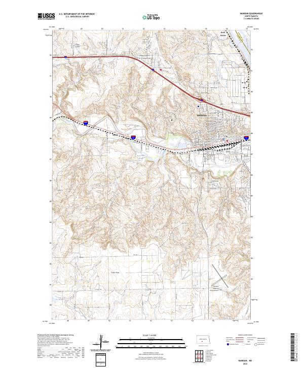
2024 Map of Mandan
USGS Topo · Published 2024About this map
Mandan serves as the regional hub at the confluence of transport and terrain, situated west of the Missouri River and divided by the Heart River. This modern survey documents the established city grid, centered on the Morton County Courthouse, while tracing the expansion of its suburban and industrial fringes into the surrounding Morton County hills. The landscape is defined by its transition from the urban density of Mandan to the agricultural expanse of Custer Flats and the nearby settlement of Sunny.
Find a feature on this map
70 named features on this map. Tap any name to fly to it.
Don’t see what you’re looking for? This feature index may not catch every label — zoom into the map to look around manually.
Map Details
Editions of this 2024 Mandan Map
This is the sole edition of this map. No revisions or reprints were ever made.
Other maps of this area

1907 · Bismarck
USGS Topo · 1:125,000

1950 · Bismarck
USGS Topo · 1:24,000

1951 · Bismarck
USGS Topo · 1:62,500

1951 · Mandan
USGS Topo · 1:24,000

1954 · Bismarck
USGS Topo · 1:250,000

1958 · Bismarck
USGS Topo · 1:250,000

1962 · Schmidt
USGS Topo · 1:24,000

1962 · Bismarck
USGS Topo · 1:24,000

1962 · Harmon
USGS Topo · 1:24,000
1962 · Burnt Butte
USGS Topo · 1:24,000