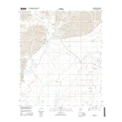
2015 Map of Manifest
USGS Topo · Published 2015About this map
Manifest and Webb serve as the primary nodes of settlement in this Catahoula Parish landscape, where the terrain transitions from upland ridges into a complex network of wetlands. The southern reaches of the map are defined by an intricate water system featuring Rhinehart Lake, Long Lake, and Round Lake, alongside slow-moving drainages like Boggy Bayou and Grassy Bayou. These lowland features suggest the seasonal flooding patterns typical of the region's alluvial geography.
Find a feature on this map
66 named features on this map. Tap any name to fly to it.
Don’t see what you’re looking for? This feature index may not catch every label — zoom into the map to look around manually.
Map Details
Editions of this 2015 Manifest Map
This is the sole edition of this map. No revisions or reprints were ever made.
Other maps of this area

1941 · Manifest
USGS Topo · 1:62,500

1941 · Jena
USGS Topo · 1:62,500

1941 · Harrisonburg
USGS Topo · 1:62,500

1953 · Alexandria
USGS Topo · 1:250,000

1953 · Natchez
USGS Topo · 1:250,000

1955 · Alexandria
USGS Topo · 1:250,000

1955 · Olla
USGS Topo · 1:62,500

1956 · Natchez
USGS Topo · 1:250,000

1958 · Jena
USGS Topo · 1:62,500

1959 · Natchez
USGS Topo · 1:250,000