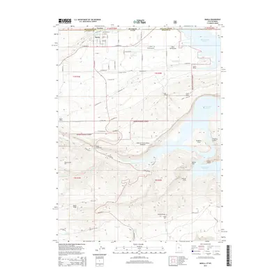
2014 Map of Manila
USGS Topo · Published 2014About this map
Manila sits at the northern edge of the high Uinta basin along the border where Utah meets Wyoming. This landscape is dominated by the sprawling waters of the Flaming Gorge Reservoir to the east, which has reshaped the local geography with its deeply inset features like Kingfisher Canyon and Hideout Canyon. The town itself is organized around a traditional grid, including local landmarks like the Manila Cem and Manila Airport.
Find a feature on this map
64 named features on this map. Tap any name to fly to it.
Don’t see what you’re looking for? This feature index may not catch every label — zoom into the map to look around manually.
Map Details
Editions of this 2014 Manila Map
This is the sole edition of this map. No revisions or reprints were ever made.
Other maps of this area

1885 · Ashley
USGS Topo · 1:250,000

1906 · Marsh Peak
USGS Topo · 1:125,000

1908 · Marsh Peak
USGS Topo · 1:125,000

1952 · Flaming Gorge
USGS Topo · 1:24,000

1954 · Vernal
USGS Topo · 1:250,000

1954 · Rock Springs
USGS Topo · 1:250,000

1958 · Vernal
USGS Topo · 1:250,000

1958 · Rock Springs
USGS Topo · 1:250,000

1960 · Vernal
USGS Topo · 1:250,000

1962 · Rock Springs
USGS Topo · 1:250,000