2023 Map of Manila
USGS Topo · Published 2023About this map
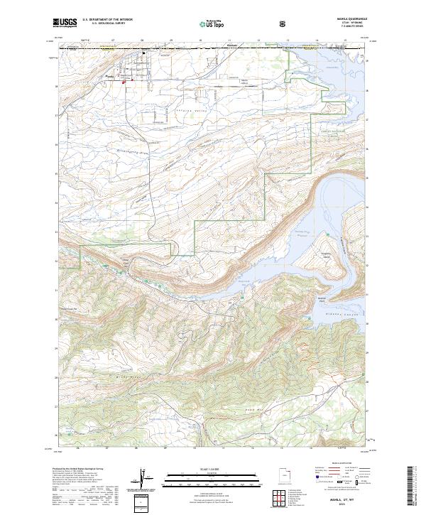
Manila serves as the primary hub of this high-desert landscape, situated just south of the Wyoming border in Lucerne Valley. As the county seat, it houses the Daggett County Court House and supports a local agricultural economy through irrigation systems like the Peoples Canal and Sheep Creek Canal. The southern and eastern portions of the map are defined by the dramatic topography of the Ashley National Forest, where the terrain drops sharply into the Flaming Gorge Reservoir. Prominent landmarks such as Beehive Point and Kingfisher Island rise from the reservoir waters, which flooded the former canyons of the Green River. A network of forest roads and trails, including the Dowd Mountain X-C Ski Trl and the Hideout-Carter Creek Trl, illustrates the modern transition of the area into a recreational destination for boating and hiking.
Find a feature on this map
63 named features on this map. Tap any name to fly to it.
Don’t see what you’re looking for? This feature index may not catch every label — zoom into the map to look around manually.
Map Details
Editions of this 2023 Manila Map
This is the sole edition of this map. No revisions or reprints were ever made.