
1954 Map of Manitowoc
USGS Topo · Published 1968About this map
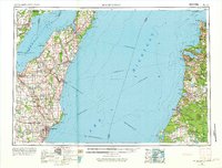
The maritime expanse of Lake Michigan serves as a central thoroughfare for the region in the mid-1950s, defined by the industrial and transit routes connecting the Wisconsin and Michigan shorelines. Major lake crossings are documented through the Ann Arbor Railway Car and Auto Ferry and the Chesapeake and Ohio Railway Car and Auto Ferry routes, which bridge the gap between ports like Manitowoc and the Michigan coast. On the western shore, the Door Peninsula separates Green Bay from the open lake, with settlements such as Sturgeon Bay, Algoma, and Oconto appearing alongside the Kewaunee Green Bay and Western railroad. Across the water, the Michigan landscape is characterized by the Manistee National Forest and Fife Lake State Forest, featuring distinctive coastal landmarks like Sleeping Bear Point and Point Betsie.
Find a feature on this map
188 named features on this map. Tap any name to fly to it.
Don’t see what you’re looking for? This feature index may not catch every label — zoom into the map to look around manually.
Map Details
Editions of this 1954 Manitowoc Map
2 editions found
Other maps of this area

1931 · Custer NW
USGS Topo · 1:31,680

1931 · Baldwin NW
USGS Topo · 1:31,680

1931 · Custer NE
USGS Topo · 1:31,680

1931 · Manistee SE
USGS Topo · 1:31,680

1931 · Freesoil SW
USGS Topo · 1:31,680

1931 · Manistee SW
USGS Topo · 1:31,680

1932 · Freesoil SE
USGS Topo · 1:31,680

1932 · Ludington NE
USGS Topo · 1:31,680

1932 · Ludington
USGS Topo · 1:31,680

1933 · Peacock SW
USGS Topo · 1:31,680