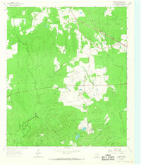
1963 Map of Manning
USGS Topo · Published 1968About this map
Manning sits at the heart of this East Texas landscape, where the industry of the early 20th century left a distinct mark on the terrain of Angelina National Forest. The presence of the Millpond and a network of Old Railroad Grades radiating from the settlement suggests a history tied closely to timber production and local milling. To the north, the small community of Shawnee Prairie serves as a secondary focal point, surrounded by family-named landmarks like Bill Hill and multiple rural houses of worship including Salem Ch and Vines Chapel.
Find a feature on this map
25 named features on this map. Tap any name to fly to it.
Don’t see what you’re looking for? This feature index may not catch every label — zoom into the map to look around manually.
Map Details
Editions of this 1963 Manning Map
Other maps of this area

1927 · Lufkin 4-c
USGS Topo · 1:24,000

1928 · Zavalla 3-c
USGS Topo · 1:24,000

1928 · Lufkin 4-d
USGS Topo · 1:24,000

1931 · Zavalla
USGS Topo · 1:62,500

1932 · Manning
USGS Topo · 1:62,500

1949 · Lufkin
USGS Topo · 1:62,500

1949 · Lufkin
USGS Topo · 1:24,000

1949 · Huntington
USGS Topo · 1:24,000

1950 · Lufkin
USGS Topo · 1:24,000

1950 · Huntington
USGS Topo · 1:24,000