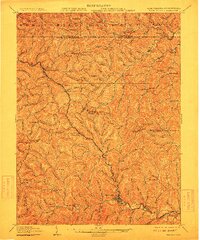
1905 Map of Mannington
USGS Topo · Published 1912About this map
Dunkard Creek and its complex network of runs carve through the borderlands of West Virginia and Pennsylvania, defining the landscape of this 1902–1903 survey. The topography is dotted with high points like Honsocker Knob and Efaw Knob, around which early Appalachian life centered. Small post offices and rural settlements such as Shamrock Brave P.O. and Downs Broomfield P.O. reveal the late-Victorian era's communication network, while Hundred Church stands as a focal point for the local community. The industrial development of the region is evident in the presence of the B. & O. R. R., which winds through the steep valleys near Glover Gap and Metz. Local transit relied on the early State Road and numerous forks like the West Virginia Fork Fish Creek, illustrating how early infrastructure followed the natural contours of the ridges and hollows.
Find a feature on this map
131 named features on this map. Tap any name to fly to it.
Don’t see what you’re looking for? This feature index may not catch every label — zoom into the map to look around manually.
Map Details
Editions of this 1905 Mannington Map
2 editions found
Other maps of this area

1901 · Waynesburg
USGS Topo · 1:62,500

1902 · Clarksburg
USGS Topo · 1:62,500

1902 · Fairmont
USGS Topo · 1:62,500

1903 · Littleton
USGS Topo · 1:62,500

1904 · Blacksville
USGS Topo · 1:62,500

1904 · Waynesburg
USGS Topo · 1:62,500

1904 · Cameron
USGS Topo · 1:62,500

1905 · Mannington
USGS Topo · 1:62,500

1905 · Rogersville
USGS Topo · 1:62,500

1905 · Centerpoint
USGS Topo · 1:62,500