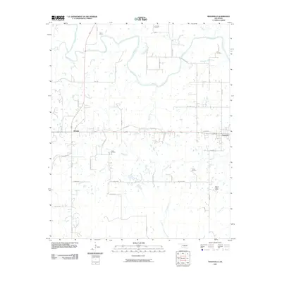
2009 Map of Mannsville
USGS Topo · Published 2009About this map
The Washita River snakes across the northern reaches of this landscape, its tight oxbows and surrounding lowlands defining the border between Carter and Johnston counties. To the west, the settlement of Dickson sits along Old US Hwy 70, while Mannsville anchor the eastern edge of the quadrangle. This area of Oklahoma is marked by a network of drainage systems, including Wolf Creek, Camp Creek, and Oil Creek, which feed into the river's basin. Genealogists and local historians will find several rural burial grounds scattered through the countryside, such as Thomas Cemetery, Lone Cedar Cemetery, and the Earl Cemetery near the river's bend. The map also documents modern infrastructure like the Marvin Poppe S Dam and a dense web of local roads, from Tater Hill Rd to the curiously named Tiny Chapel Rd.
Find a feature on this map
45 named features on this map. Tap any name to fly to it.
Don’t see what you’re looking for? This feature index may not catch every label — zoom into the map to look around manually.
Map Details
Editions of this 2009 Mannsville Map
This is the sole edition of this map. No revisions or reprints were ever made.
Other maps of this area

1901 · Tishomingo
USGS Topo · 1:125,000

1901 · Ardmore
USGS Topo · 1:125,000

1918 · Ardmore
USGS Topo · 1:125,000

1957 · Ardmore
USGS Topo · 1:250,000

1963 · Ardmore
USGS Topo · 1:250,000

1963 · Madill
USGS Topo · 1:24,000

1963 · Mannsville
USGS Topo · 1:24,000

1963 · Troy
USGS Topo · 1:24,000

1963 · Ravia
USGS Topo · 1:24,000

1963 · Mc Millan
USGS Topo · 1:24,000