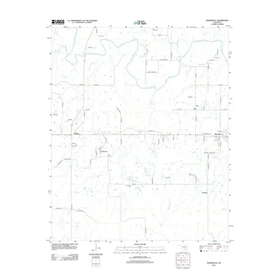
2012 Map of Mannsville
USGS Topo · Published 2012About this map
The Washita River meanders across the northern landscape of this Carter County region, where the community of Mannsville sits as a primary eastern anchor. To the west, the residential patterns of Dickson and the smaller cluster at Durwood reveal the settlement character of the early 21st century. This area is notable for its numerous small family and community burial grounds, including Thomas Cem, Lone Cedar Cem, Earl Cem, Nelda Cem, Durwood Cem, and Rollins Cem, providing a dense network of sites for genealogical research. The terrain is defined by a system of creeks such as Wolf Cr and Camp Cr, which drain into the Washita. Local infrastructure is represented by several historical corridors, including Old Hwy 70 and Old Hwy 18, connecting these rural communities and smaller hamlets like Earl and Simpson.
Find a feature on this map
76 named features on this map. Tap any name to fly to it.
Don’t see what you’re looking for? This feature index may not catch every label — zoom into the map to look around manually.
Map Details
Editions of this 2012 Mannsville Map
This is the sole edition of this map. No revisions or reprints were ever made.
Other maps of this area

1901 · Tishomingo
USGS Topo · 1:125,000

1901 · Ardmore
USGS Topo · 1:125,000

1918 · Ardmore
USGS Topo · 1:125,000

1957 · Ardmore
USGS Topo · 1:250,000

1963 · Ardmore
USGS Topo · 1:250,000

1963 · Madill
USGS Topo · 1:24,000

1963 · Mannsville
USGS Topo · 1:24,000

1963 · Troy
USGS Topo · 1:24,000

1963 · Ravia
USGS Topo · 1:24,000

1963 · Mc Millan
USGS Topo · 1:24,000